Built for AECO needs and workflows
MAVO 3D
Portable Precision
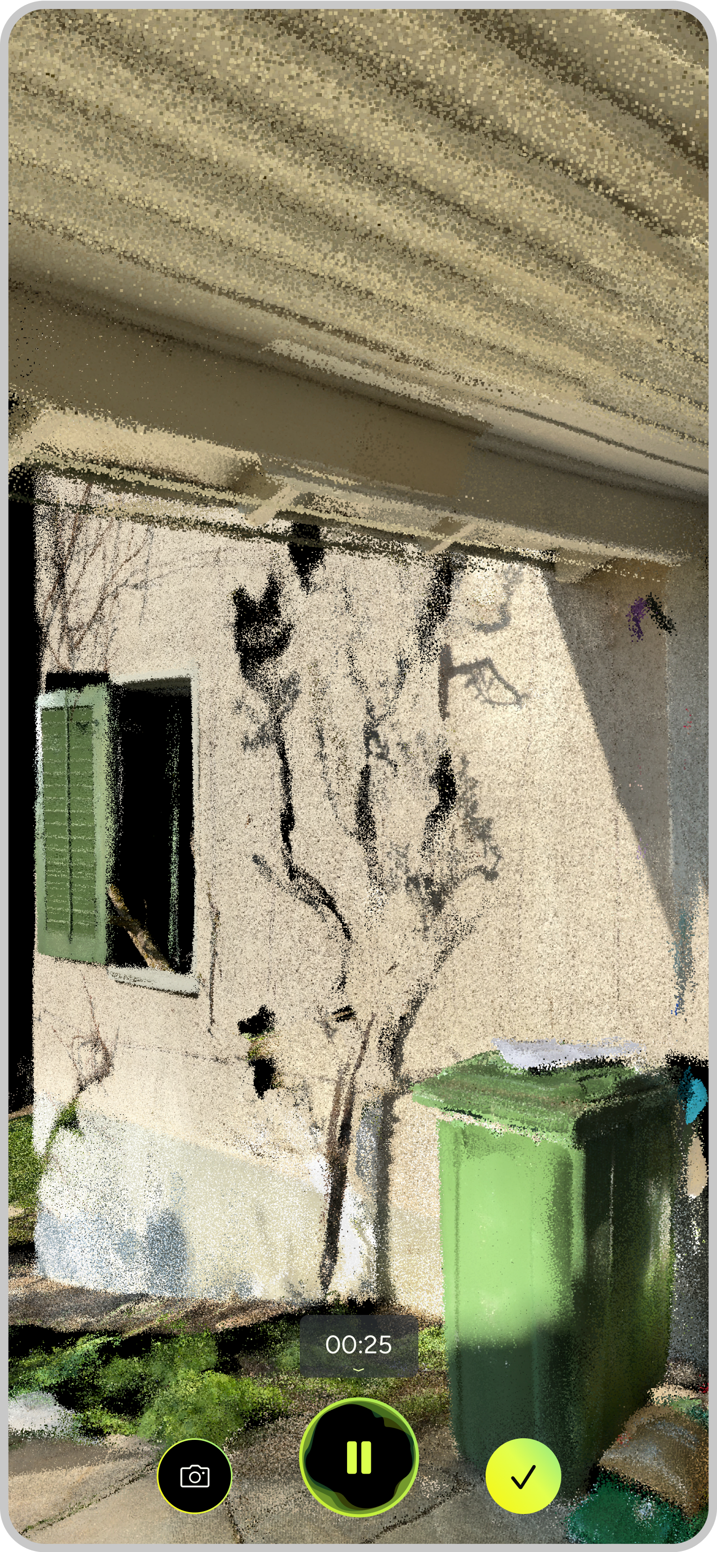
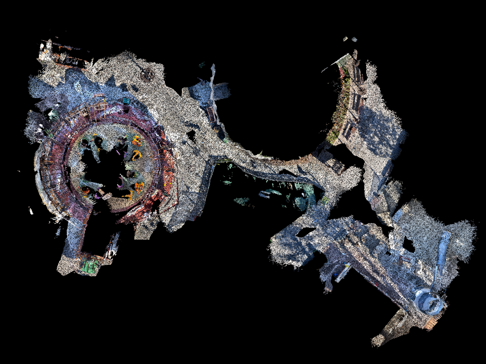
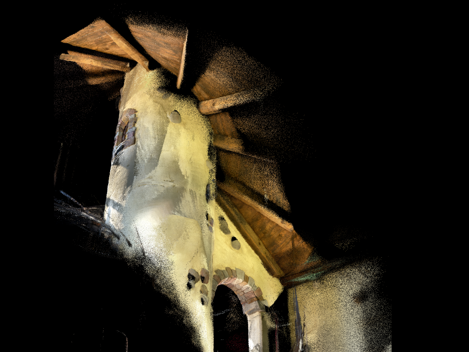
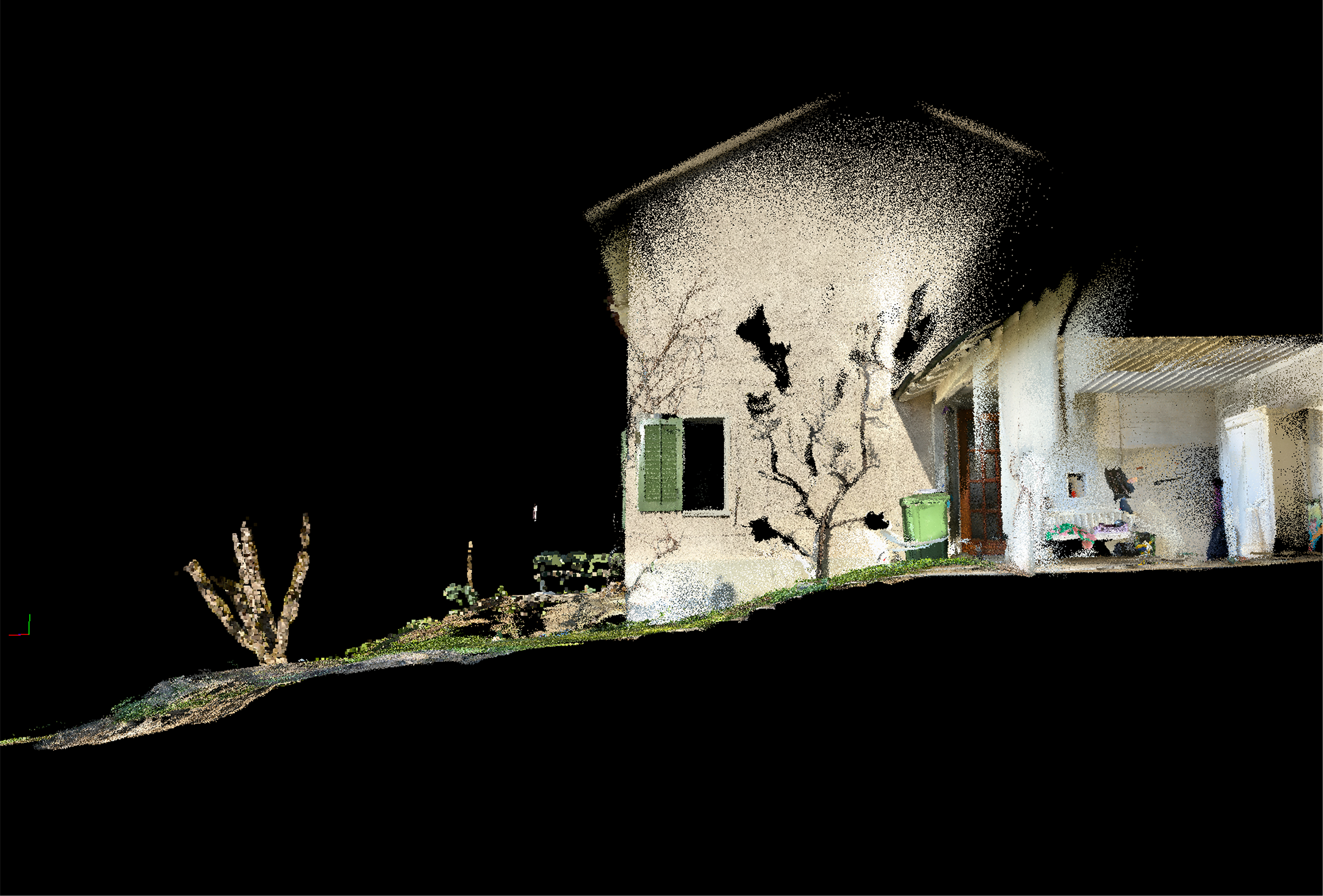
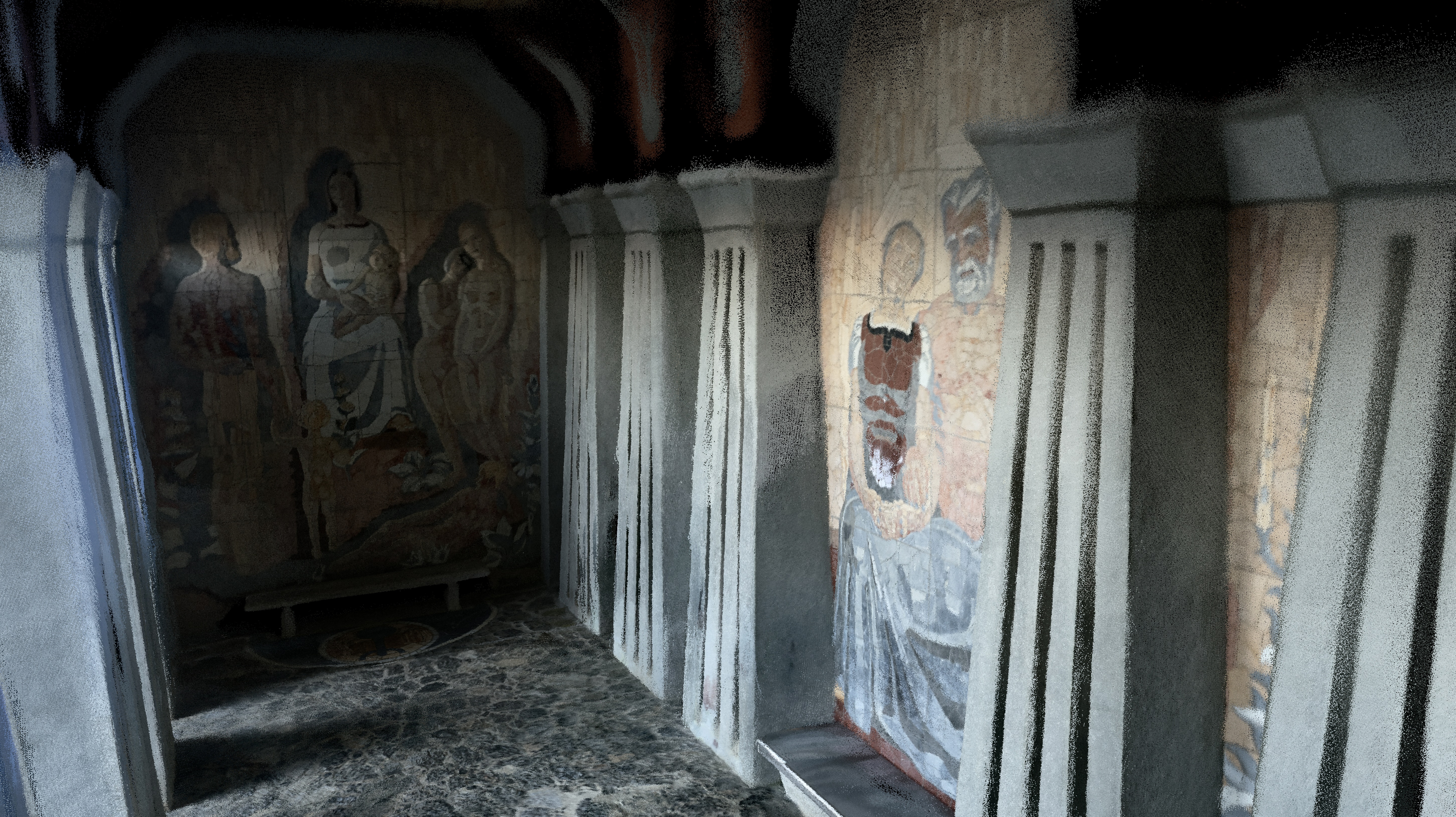
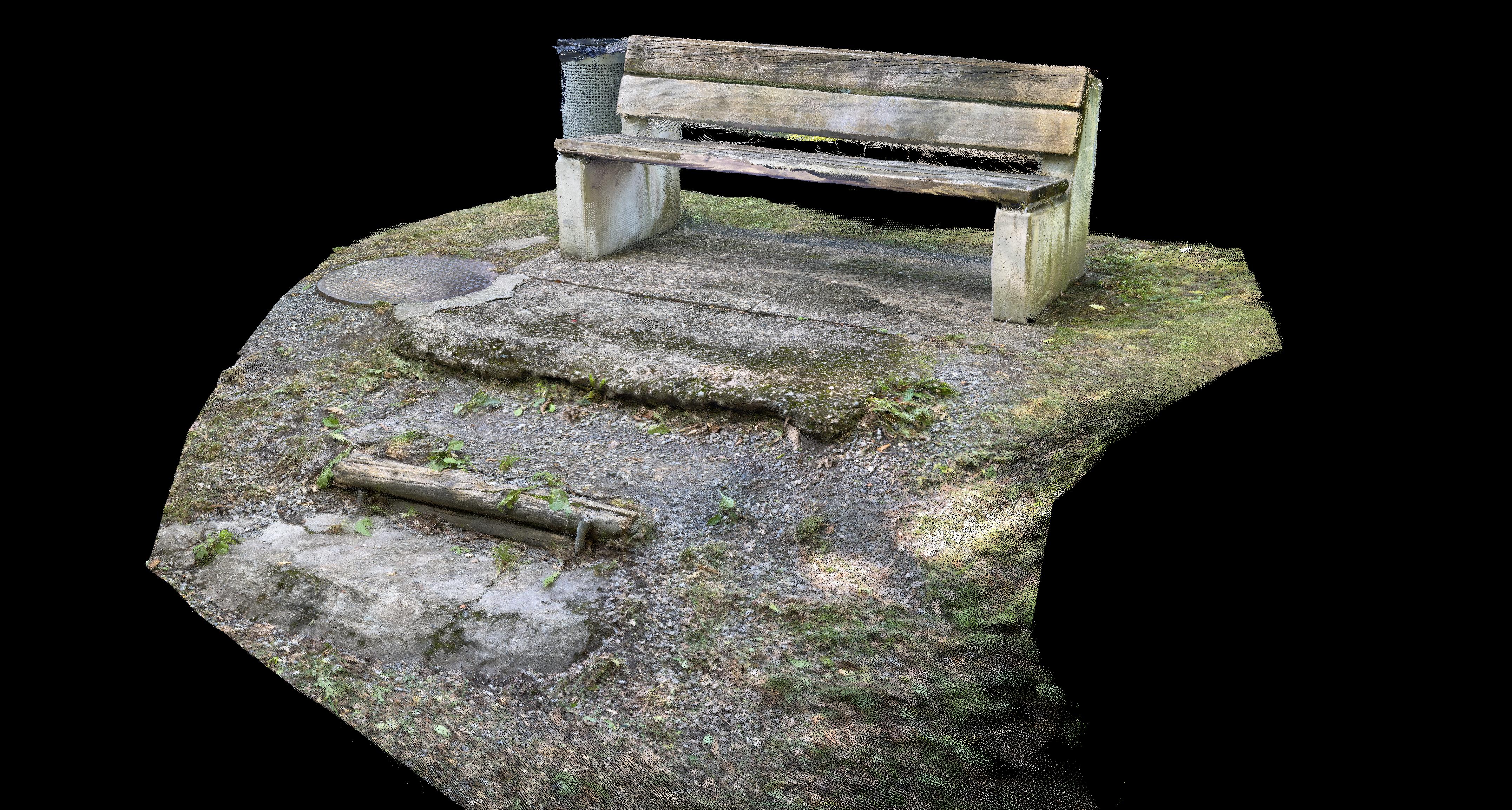
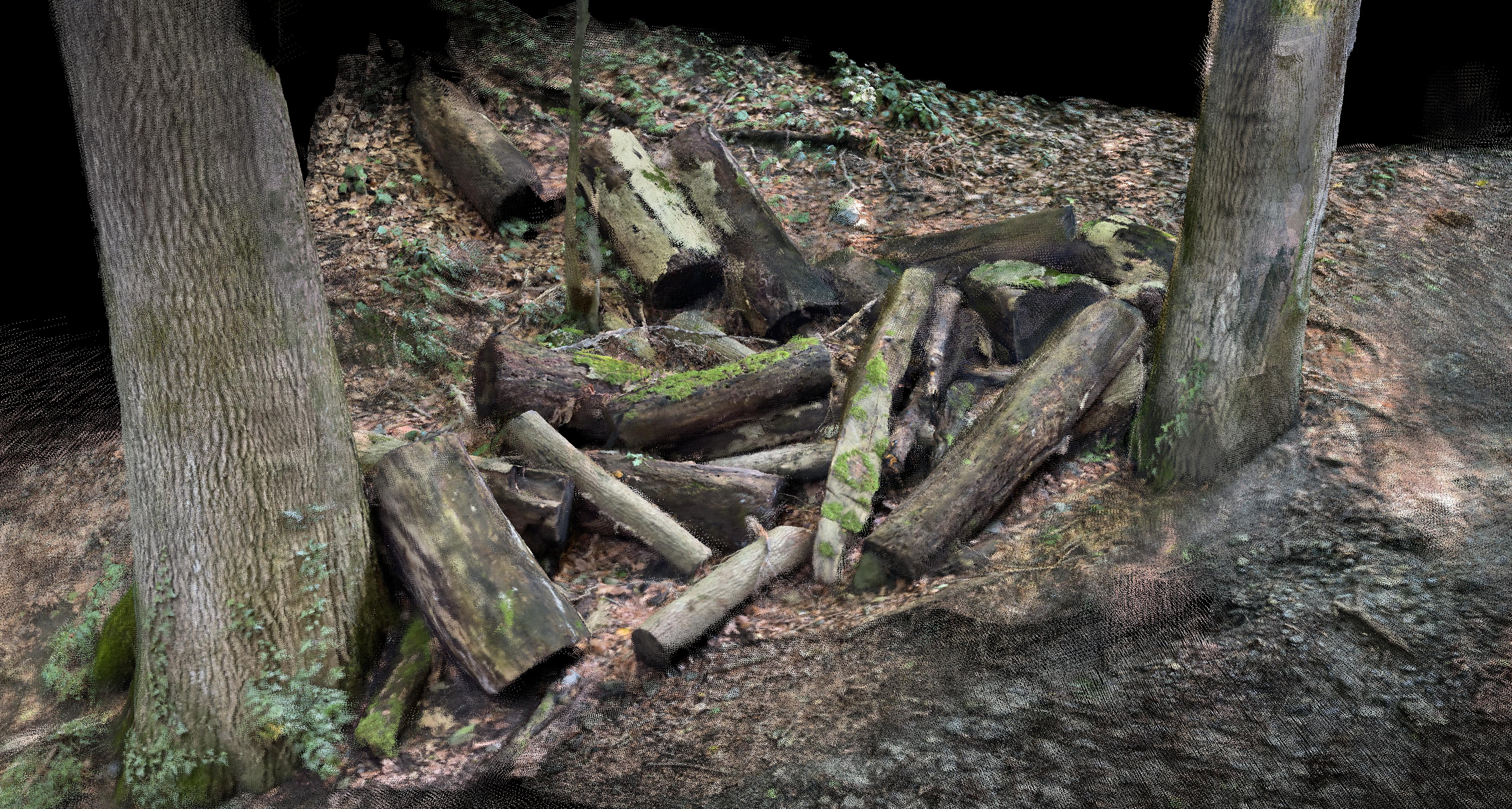
Generate precise, ready-to-use 3D point clouds for as-built documentation with your iPhone Pro and iPad Pro.
MAVO 3D is built for real builders. Ready to set up and deploy across your team. No expensive vendor lock-ins, exportable in modern open industry formats, 100% data privacy.
Developed & maintained by 3D software engineering experts in Switzerland.
Available for iPhones and iPads with LiDAR Sensor.
Download the most accurate 3D scanning app now.
What is MAVO 3D?
Technological foundation
MAVO 3D is a mobile 3D LiDAR scanning solution. It relies on a proprietary CORE with a SLAM-based algorithm (Simultaneous Localization and Mapping) to calculate the devices position while you are moving.
MAVO 3D processes and optimizes raw capture data input while scanning and additionally as a post-processing step to let you create high quality 3D models in open industry standard formats.